
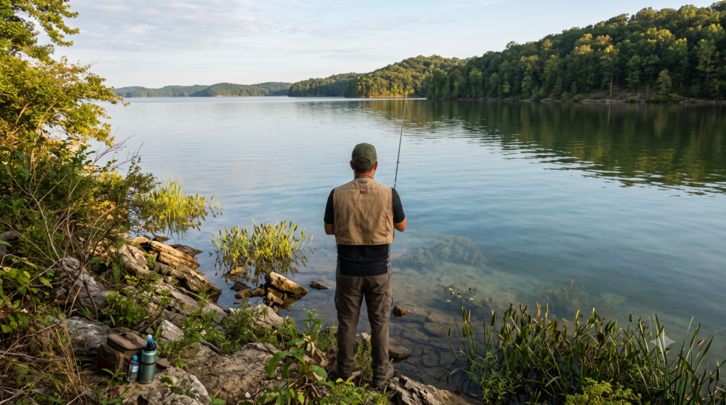
Every Lake Guide · Bank-Fishing Field Lesson
The lake has a floor. Learn where it changes.
The first useful drop-off may be closer than the longest cast you can make. A few controlled casts can help you find it—without a boat, a depth finder, or a perfect underwater map.
- No sonar required
- Beginner friendly
- Three-cast field test
- L.A.K.E. Method
The quick answer
How can a bank angler find a drop-off without sonar?
Choose one safe casting position and use the same lure, similar cast lengths, and a consistent sink-count. Make a short cast, a diagonal cast, and a longer cast. Compare how long the lure takes to reach bottom, what the retrieve feels like, and where grass or bottom contact suddenly changes. A repeatable increase in fall time—or a clean change from weeds or bottom contact to open water—can reveal the first drop or outside edge.
The goal is not to calculate an exact depth. It is to find a useful transition you can reach again from shore.
A lake can look flat from the bank even when the bottom is not. The shoreline may continue as a shallow shelf, slide down a gradual slope, or break sharply only a short distance from your feet. That difference matters because a drop-off can connect shallow feeding water with deeper, more stable water. It gives fish a route, not a reservation. Your job is to find the route and then decide whether today’s wind, shade, cover, food, water color, and fish activity make it worth fishing.
Why the first drop-off deserves a bank angler’s attention
1
It connects two kinds of water
Fish can move between a shallow shelf and deeper water without crossing a large empty area. That connection may become useful as light, temperature, pressure, or water level changes.
2
It can create a travel edge
A break in depth gives fish a boundary to follow. When that boundary also touches grass, rock, wood, shade, a point, or a cove mouth, the explanation becomes stronger.
3
It is often reachable
The first drop is not always in the middle of the lake. A steep bank, dam corner, point, outside weed line, or darker nearshore strip may put useful depth within an ordinary cast.
Every Lake Guide rule
A drop-off is a clue—not a guarantee. Give it more weight when it overlaps with food, comfort, cover, movement, safe access, or recent fish activity.
Read the land before you try to read the bottom
The visible bank can suggest what may continue below the surface. It cannot prove the underwater shape, but it gives you a sensible place to begin testing.
| What you see from shore | What it may suggest | Best first test | Do not assume |
|---|---|---|---|
| Steep bank, bluff, dam face, or |
| Depth may become available close to shore | Make diagonal casts that cross several depths | Every steep bank drops at the same angle underwater | |
| Broad, gently sloping shoreline | A flat or gradual taper may extend away from the bank | Compare short and long sink-counts for a delayed change | Flat-looking water is featureless everywhere |
| Consistent outside weed line | Plant growth may stop where light, depth, or bottom type changes | Trace the clean edge, then cross it at an angle | The deepest weed edge is automatically the best spot |
| Point, cove mouth, or bank corner | The bottom contour may bend or concentrate a travel route | Fan-cast both sides and compare the angle of the break | The visible tip is the only useful part of the feature |
| Water shifts from light to dark | Possible depth, shade, vegetation, stain, or bottom-color change | Test it with sink time and bottom feel | Dark water always means deep water |
A repeatable field test
Cast, Count, Compare
This test works because it compares casts instead of pretending a sink-count is an exact depth gauge. Use one lure whose descent and bottom contact you can recognize. Keep the lure, line, and retrieve the same while you change only the angle or distance.
Establish the nearshore baseline
Make a controlled short cast. Count at a steady pace until the line stops falling or the lure reaches bottom. Retrieve slowly and notice grass, rock, mud, wood, or a clean path.
Cross the suspected break
Cast diagonally so the lure travels from deeper water toward the bank. Watch for a sudden change in sink time, line angle, grass contact, or the amount of bottom you feel.
Compare the other side
Make a similar cast a few yards left or right. If the same change repeats, you may have found an edge. If it disappears, you may have crossed a small pocket, point, clump of cover, or irregular bottom.
Keep the comparison honest
Wind, current, line diameter, lure weight, cast distance, weeds, and a bowed line can change the count. Compare nearby casts made with the same setup under similar conditions. Record a relative difference—such as “longer fall past the grass”—instead of claiming an exact number of feet.
What the lure may be telling you
The sink suddenly takes longer
The bottom may have fallen away, but first rule out a longer cast, wind-driven bow in the line, or a lure that never reached bottom. Repeat the cast before treating it as a depth change.
Grass contact stops abruptly
You may have reached an outside weed edge, an opening, or water too deep or unsuitable for that vegetation. Fish both the clean side and the vegetated side before choosing between them.
Steady resistance becomes hard taps
The lure may have moved from soft bottom to gravel or rock. A bottom transition beside a drop can be more interesting than depth alone.
The lure feels weightless or changes direction
A fish may have taken it, the lure may be falling over the break, or slack may have formed. Reel down and respond deliberately when the line moves unnaturally—do not jerk at every change.
Important: No bottom-reading method is worth losing tackle in obvious submerged wood, heavy rock, cables, posted habitat structures, or unsafe current. Choose a snag-resistant presentation and a safe angle. Never enter the water to recover a lure.
Start with the lake, not the lure
Use the L.A.K.E. Method at the first drop
L
Look
Study bank slope, water color, grass, wind, shade, surface activity, access, and safe casting room.
A
Analyze
Compare a steep bank, point, cove mouth, weed edge, and flatter control area. Predict where the first break may run.
K
Key In
Favor the reachable section where the depth change touches cover, food, shade, wind, or a travel route.
E
Execute
Cast, count, compare, and repeat. Change one angle or depth at a time, then follow the strongest evidence.
If you want to practice the complete clue-ranking system, the How to Read Any Lake field guide connects depth, edges, wind, cover, food, comfort, and fish movement into one repeatable process.
How different fish may use the first break
Species, season, weather, lake type, oxygen, forage, and fishing pressure all influence position. Use these as starting explanations to test—not promises.
| Fish | Useful drop-off connection | What to test from shore |
|---|---|---|
| bass | Outside grass, a |
| end, point, shade, or rock-to-soft-bottom change | Cast along the break, then cross it; compare the top, face, and bottom | |
| Bluegill and sunfish | Weeds, brush, dock shade, or small cover beside slightly deeper water | Adjust bobber depth or count a small presentation down beside the edge |
| Crappie | Reachable brush, dock corners, standing cover, or suspended fish near the break | Test several depths instead of dragging only along the bottom |
| Channel catfish | A flat dropping toward deeper water, a cove route, point, inflow, or low-light feeding shelf | Place a legal bait near the transition and compare distance deliberately |
| Stocked trout | Comfortable water, an inflow, shade, or reachable depth away from the most pressured bank | Count presentations through the water column; do not assume every trout hugs bottom |
A focused Kentucky outing
Build the first-drop test into two hours
Minutes 0–10
Read before rigging
Choose two safe areas with different shoreline shapes. Check wind, water color, shade, grass, visible activity, posted rules, and the safest route back.
Minutes 10–35
Map one small section
Use Cast, Count, Compare from one position. Mark the useful angle with a stationary landmark across the lake so you can repeat it.
Minutes 35–75
Fish the top, face, and bottom
Give the suspected break several controlled presentations. Change depth or angle once before changing the entire setup.
Minutes 75–105
Compare a different bank
Test the second shoreline shape. The goal is to learn whether depth—or depth combined with wind, shade, cover, or food—explains the activity.
Minutes 105–120
Return to the strongest evidence
Finish where the most useful clues overlapped. Save one note: casting landmark, approximate sink-count, bottom change, wind, water color, and any bite or follow.
Six mistakes that can create a false map
- Changing lures during the test. A different weight or shape can change fall time and bottom feel.
- Comparing very different cast lengths. More distance can create more sink time even when the bottom is unchanged.
- Counting through a bowed line. Wind and current may keep the lure from falling the way you expect.
- Treating one cast as proof. Repeat the angle and compare the same zone from slightly left or right.
- Confusing dark water with deep water. Shade, vegetation, stain, and bottom color can all darken the surface.
- Finding the drop but ignoring the day. A bare break with no food, cover, comfortable water, movement, or activity may be less useful than a modest edge where clues overlap.
Reader challenge
Map one casting lane—not the whole lake
On your next trip, choose one safe bank and make five controlled casts through the same lane. Use a landmark on the far shoreline to keep the angle consistent. Record only four things:
- the sink-count on the shallow side;
- the sink-count beyond the suspected break;
- the point where grass or bottom contact changes; and
- whether fish activity connects to the top, face, or bottom of that edge.
If you can repeat the useful lane tomorrow, you have learned more than an exact depth number would tell you.
Four-question knowledge check
Can you read the first drop?
Choose the strongest answer for each field decision, then check your score.
Continue learning
Turn one depth clue into a complete lake-reading system
How to Read Any Lake
Use the complete L.A.K.E. Method to compare edges, depth, wind, cover, food, comfort, and movement. Includes field routines, practice examples, a lake scorecard, and printable tools.
Explore the Lake-Reading Field Guide →
Kentucky Shore Fishing
Study coves, flats, drop-offs, cover, and the shoreline routes a bank angler can actually reach—then practice the decisions on Kentucky water.
Explore the Shore-Structure Field Guide →
Keep the depth test safe, legal, and fish friendly
Protect your footing
Do not back toward traffic, step onto unstable rock, climb a closed bank, or wade into unknown depth to change a casting angle. Leave immediately when thunder is heard.
Protect the fish
Keep pliers ready, wet your hands, minimize air exposure, support the fish, and consider barbless hooks or crimped barbs—especially in hot weather.
Check the exact water
Confirm current licenses, seasons, size and daily limits, bait rules, public access, park hours, and posted restrictions before fishing or keeping fish.
Frequently asked questions
What lure should I use to find a drop-off from shore?
Use a presentation whose fall and bottom contact you can recognize and control. A compact jig, weedless soft plastic, small weight, or another appropriate bottom-contact option can work. Match hook exposure and weight to the cover, depth, current, line, and snag risk. The best mapping lure is the one you can cast consistently without putting yourself or wildlife at risk.
Can I convert a sink-count into exact water depth?
Not reliably without carefully calibrating the entire setup. Lure shape, weight, line diameter, wind, current, slack, weeds, and cast angle all affect the fall. For bank fishing, relative comparisons between controlled casts are usually more useful than claiming an exact depth.
Is the bottom of the drop-off always the best place to fish?
No. Fish may use the shallow top, the sloping face, the lower edge, suspended cover beside it, or a nearby point or turn. Test several positions, then let bites, follows,
, and repeatable activity narrow the answer.
How can I remember the location after I find it?
Line up your casting lane with a fixed object on the far bank, then note your standing position, cast angle, approximate distance, sink-count change, bottom feel, wind, and water level. Avoid relying only on a tree or movable object beside you.
Does a steep shoreline always mean deep water nearby?
No. It is a useful visual clue, but erosion, construction, sediment, submerged shelves, and changing lake levels can make the underwater slope different from the bank. Test the prediction with controlled casts.
Do I need to fish on the bottom to catch fish near a drop-off?
No. The mapping test may use bottom contact, but fish can suspend beside the break or move across its top. Once you locate the feature, choose a presentation depth that fits the species, conditions, forage, and feedback you observe.
Helpful Kentucky sources
- Kentucky Department of Fish & Wildlife Resources: Fish Habitat — habitat sites can occur on flats, points, pockets, and creek areas, and their useful depth varies.
- Kentucky Fish & Wildlife: Pond Vegetation — aquatic plants can provide shade, cover, and habitat for prey and aquatic invertebrates.
- Current Kentucky Fishing & Boating Guide — verify the latest statewide and
- rules before every trip.
Accuracy reminder: Regulations, access, water levels, weather, habitat, and fish behavior can change. Follow posted signs and current official information for the exact
.
You do not need a perfect map. You need one repeatable edge.
Read the shoreline. Make controlled casts. Compare what changes. Then fish the part of the break where depth meets another reason for fish to be there.
Start with the lake—not the lure.
Build the Complete Lake-Reading System